Day 19
Sunday July 3, 2016 Dawson City, YT, Gold Bonanza RV Park, #74B
334 miles (538 km) 11.4 mpg
Left Pioneer
RV Park in Whitehorse at 05:30 for a nice early start. It took us 8.5 hours to get up to Dawson
City. We do not like this campground. It’s dumpy, everybody is on top of each other
and we’re paying for hookups we don’t need.
But we will be taking the Dempster Highway tomorrow to Eagle Plains
without the Oliver, and needed to have it in a private campground so we could
feel comfortable leaving it. At first
they wanted us here:
We called it the ghetto. They wanted us between the two motorhomes on the right. The white motorhome is from Lake City, MI.
We went back
to the office and “upgraded” to this:
I probably
don’t have to say this, but the ride up was very scenic. The mountains are lower and the trees are
more deciduous and less conifer. The
highway followed three large rivers, the McKenzie, the Stewart, and the Yukon
Rivers. All flow north. Here of some photos taken from the road.
 |
| Bridge over the Stewart River |
 |
| The Klondike Highway turnoff from the Alaskan Highway, just west of Whitehorse |
 |
| A sign warning us of elk. I didn't know Alaska had elk. We didn't see any. |
 |
| Carmacks is the only town between Whitehorse and Dawson Creek. |
 |
| Five Finger Rapids on the Yukon from an overlook. |
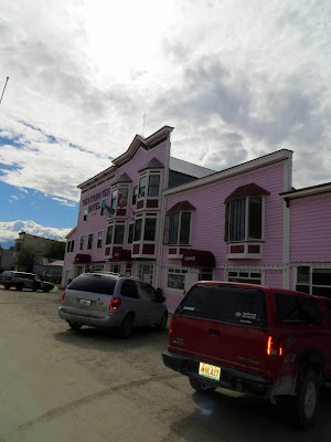
Dawson City
was a nice little town. It was the
center of the Yukon Gold Rush in 1896 to the early 1900’s. Many historical buildings still around and
many still being used. There is some
touristy stuff, but not tacky at all like Skagway. There are saloons, restaurants, and hotels. All look authentic, not fake. The main drag is paved but all other streets in town are dirt.
 |
| This is the main grocery store in town. It has wooden floors and a lot of character. |
First went to the Northwest Territories visitor center to get info on the Dempster
highway to Inuvik. I did a lot of
research on this before we left because there are horror stories and bad advice
all over the internet on this. The
highway was completed in 1971 and starts just south of Dawson City and ends
about 400 miles north at Inuvik, NT. It
was originally paved with shale and the sharp stones would cut the tires and
create lots of flat tires. There are no
services along the first 250 miles except at Eagle Plains, 21 miles south of
the Arctic Circle. The person at the
information center told me that the road was regraded years ago with gravel all
the way and is excellent condition.
Next stop
was the Dawson City visitor center.
We
did no sightseeing today but will when we return from Eagle Plains. We went to Sourdough Joe’s, known for their fish and chips, and had lunch of
fish and chips made with “real” Alaskan cod, homemade tartar sauce, and
home-made fries. It was really, really,
good. Also had some beer from the
Whitehorse Brew Co.
The McKenzie
highway ends at Dawson City at the Yukon River.
To continue, there is a free ferry provided by the Yukon government that takes you across the Yukon
River, where the Top of the World Highway will take you to the Alaskan
border. That will be our next adventure
when we get back from the Arctic Circle.
We sat on a bench on the river and watch the ferry go back and forth.
Topped of
gas tank and returned to campground. The
guy next to us in huge 42 ft. 5th-wheel was from just north of
Battle Creek, MI. His first Alaskan
trip, too. A very large pick-up camper
was behind us with a couple from Arkansas.
Kind of hippy. Grey hair pulled
back in a pony tail.
Overall,
another excellent day in northern Canada.
For desert, here's some of Marsha's pictures of the local flora. We have no fauna pictures to show you.
 |
| This grass with the iridescent tops is common along the road in some areas and is very pretty. |


No comments:
Post a Comment