Sunday, August 28, 2016

A National Forest Campground Accessed Through an I-90 Rest Area


Day 69  Monday August 22, 2016            Lolo National Forest, Quartz Flats Campground
319 towing miles            11.2 mpg

We stayed hitched up last night for a fast get-a-way this morning. 


One of the worse RV parks we've stayed in and were glad to leave.
We wanted to get from Washington to Montana, close enough to be a few hundred miles from the Yellowstone area.
But before we could leave, we noticed our black and gray water tanks were at 55%, a surprise because we dumped two days ago.  They don’t fill up that fast.  We may have not been level when we dumped.  So that makes one more chore before we leave, dump tanks.  Our site had full hookups so I was able to do it there.  We left at 07:05.  Drove six miles south to Omak where we stopped at the local Safeway for a few things like bread and milk.  It wasn’t a very big Safeway.  Then next door was Burger King and we tried their Egg-Normous breakfast burrito.  Which was very good.  Had to fuel up, too.  It wasn’t until 09:30 before we hit the road.

Worked our way down US-97 to WA-174 to US-2 to I-90.  174 follows the Columbia River.  On both sides of the river, for miles, are fruit orchards.  Mostly apples, but also peaches.  I wrote about that two years ago when we followed the Columbia River Valley on the way to Oregon.  This time we got to see the Grand Coulee Dam, although I missed the visitor center, so I kept going.
We got on I-90 west of Spokane and had to pass through the city, but it was quite easy.  Spokane looked like a nice city, as far as cities go.  Here's the desert type scenery of western Washington until we got to Spokane.


Grand Coulee reservoir.  Did not get photo of dam.

I can see where I'm going to be an hour from now,

We could see this wildfire for miles. 

Coming up on Spokane.

It is in an area surrounded by mountain scenery.  After Spokane, it became more mountainous with heavily forested peaks and valleys. 

We crossed into Idaho and stopped at the 1st rest area which also was a visitor center and a watercraft inspection area.  These are common in western states because they don’t want Michigan zebra mussels messing up their waterways.  I had never been to one of these because I never traveled out west with a watercraft.  They asked me what lakes I was in and where they were.  None of the lakes I mentioned in British Columbia or Alaska were in their database.  They let us go after looking the canoe over.

Couer d’Alene, ID was the next small city or large town we passed through.  It is in a beautiful mountain valley with a beautiful alpine lake nearby.  It was pretty much an up-scale tourist area.  The rest of I-90 through Idaho was through heavily forested mountains and beautiful scenery.  It is amazing how they can build an interstate through mountains like that.  It was very curvy with 7% or 8% grades.  The part of Idaho we went through was the skinny part in the north section of the state.  Here's our pictures from Spokane through Idaho and Montana.


This fire was right off the highway and there was no one fighting it.

Our destination was Quartz Flats Campground near the town of Superior, MT.  It is in the Lolo National Forest.  It is accessed by getting off at a rest area and the campground access is right there.  It has loops on both sides of the highway (I-90).  There is a tunnel under the highway, actually a big culvert that connects the two sides.  We stayed on the west-bound side because it had some nice pull-throughs overlooking the Clark Fork River.  It was a very nice campground but you could hear the traffic noise.  We arrived there at 3:00 PM Mountain Time.  Lost another hour due to time zone change. 


Marsha's campsite picture.

Ed's campsite picture.

This rest area also had a Montana Fish & Game Watercraft Inspection Station also.  It was a little stricter than Idaho.  Many more questions and he was going through a checklist with my name and address and filling in all my answers.  We got a certificate that we passed in case we have to pass through another one. 

We had cell signal there and I was able to post three blog drafts that were ready to go, Whitehorse day 1 and 2, and Big Creek (another chance at Grayling).  When you receive these postings, look at the date they were written, not posted.

Saturday, August 27, 2016

Back in the U.S.A.


Day 68  Sunday August 21, 2016                            Riverside, WA   Glennwood RV Park
342 miles towing            11.3 mpg

This was a very difficult, stress full travel day.
We left Big Country RV Park at 08:00. 

Followed 97 most of the way.  Got on some wrong roads that made the trip longer and slower.  One of them was a beautiful mountain road between Kamloops and Monte Creek.  It was slow and curvy, but beautiful.  We picked up 97 again and after about 20 miles on a divided highway along the top of a ridge above tree line we ended up in heavily congested resort towns on a skinny two lane road with bumper to bumper traffic that followed Okanogan Lake for miles.  To make matters worse, I was almost out of gas and those little towns don’t have gas stations fit for people with trailers.  I finally found one after my Fuel Tank Low light was flashing at me. 


Tourists floating down what looks like a drainage ditch.  This went on for miles.


One of many vineyards in Oliver, B.C.

Once we got out of that mess, we came to the wine region of British Columbia at a town called Oliver.  Wineries everywhere.  The Napa Valley of Canada. 
In Osoogoos, B.C. we arrived at U.S. Customs at 2:45. They asked about fruits and vegetables, alcohol, and any goods purchased in Canada.  But didn’t ask about firewood!  Then they pulled us over for inspection, but were very nice about it.  The agent asked me to open the camper and asked me inside with her.  She looked inside the refrigerator and pantry and nothing else.  Then she spent a few moments telling us three different ways of getting to Spokane and the different experiences along each of the routes.  And onward we went.

The next biggest town would be Omak, WA, about an hour away.  We went there and went to Burger King because we were starved and needed instant gratification.  We then sat in a Walmart parking lot wondering where we would stay the night.  We were back in the land where cell phones have data networks that work.  We found one six miles back up the road.  We called ahead to make sure they had spaces and they did.  Fifteen minutes later, we had a spot.
This was not a very nice RV Park.  It was full of permanent residents living in old camping trailers driving old beat up trucks.  Some of them had plywood skirting around them.  There were some large 5th wheels with nice trucks to tow them.  These were the people who lived there because they worked in the area.  At this point, I was just happy to have a place to stay.  Did I say it was 94o.

It was a long, hard day.  But we’re back in the U.S.  Our plans are to work our way to the Yellowstone area.  I want to spend some time on the Madison River 1st, then go to Mammoth Hot Springs campground in the park through Labor Day weekend, then work our way home.

Last Full Day in Canada


Day 67  Saturday August 20, 2016           Big Country RV Park & Campground, site 32
494 towing        10.6 mpg

We were all hooked up ready for a fast getaway to get an early start.  As soon as the coffee was done we left the Cassiar RV Park at 06:55.  We drove south on the Cassiar to Trans Canada-16 and turned east.  About 30 km on 16 we came to a town called Hazelton.  They had a sani-dump (Canadian for dump station) and we used it.  We didn’t like the one at the Cassiar RV Park because it was located in a spot where it would block traffic while you were using it.
We went through Prince George where we picked up BC-97 and took it south.  Followed it to just south of the town of Williams Lake.  Our original plan was to follow the same route to Lac La Hache Provincial Park.  But it was getting warmer as the day went on up to 930.  We decided to go private so we could have electric for the AC.  Our Alaska RV guide was no longer relevant and we were on our own to find a place to stay.  Marsha has apps on her phone for this, but it does no good when Canada has crappy data coverage.  I used my GPS to find campgrounds in the Williams Lake area.  But we have no way to research them.  Just show up and hope it’s OK.

As it turned out, it was not bad.  It looks like it used to be a KOA.  It started cooling down towards evening.  Tomorrow we would be crossing the US border into Washington and I needed to get rid of my firewood.  I had two bundles.  I hated to do that but I don’t want to do anything that might flag an inspection.  We sat out and burned one bundle and left the other behind.  I had my refillable fire starter too near the fire ring and it exploded.  It didn’t start a brush fire, fortunately and no debris went flying.  We were lucky.  I’ve been looking for another just like it and so far haven’t found one.
The scenery along the way was mountains, not as high as further north, and we also went through some rolling prairie type terrain with fields of hay.  But there were always mountains visible.


Along highway 16 we stopped at a rest area to make lunch.  Shortly afterwards there were ambulances, fire trucks, and police cars going east and about ½ mile up the road the traffic was backing up.  After lunch when we were ready to leave, the traffic was moving, but the emergency vehicles were all on the scene.  As we got to the scene of the accident, you could see skid marks veering off to the right, and down into a ravine.  At the bottom of the ravine was an upside down pickup truck with and some people on stretchers.  An EMT was looking into the cab of the truck.  It’s hard to believe anyone survived, but we never heard any more about it.
We arrived at the Big Country RV Park at 5:30 PM, a long day.  Made a meal of grilled barbecue pork chops with potatoes.  Then made a fire and blew up my fire starter.

Tomorrow, U.S.A.

Friday, August 26, 2016

Stewart-Hyder


Day 66  Friday August 19, 2016                Kitwanga, British Columbia              Cassiar RV Park, site 5
187 towing miles            11.3 mpg

Before leaving this morning we wanted to check out the laundry facility at Meziadin Junction.  It was only a mile away.  It’s a gas station, worker barracks, mess hall advertising as a café.  The laundromat was the laundry facility for the barracks.  The place was run by First Nation.  We bought gas and left.

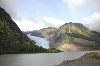
We were already to go, just needed to connect the truck to the trailer.  We left Meziadin Lake P.P. at 07:55.  We headed for Stewart-Hyder about 30 miles away.  Stewart, BC and Hyder, AK are sister towns located at the end of a long fjord off the Pacific Ocean.  Stewart is the larger of the two towns.  Both are very small.  They are at the end of a 32 mile paved road (BC-37A) off the Cassiar Highway.  It was a beautiful drive with high mountains, glaciers, and glacial rivers and creeks, and numerous waterfalls coming off the mountains.  Here’s some pictures along the Stewart Highway.


The Bear Glacier


The Bear Glacier Zoomed In

The Bear Glacier Zoomed in Even More.  Note the blue tints of the ice.
We were hoping to get laundry done there if we could.  Also wanted to wash the mud off the truck and trailer.  There were several RV parks in both communities.  But these were not the reason for going there.  We wanted to see the scenery and most of all see the National Recreation Area Wildlife Viewing Area platform where we could watch bears eat spawning salmon up Fish Creek. 

We went to the viewing platform and there was lots of spawning salmon in the stream.  They were pink salmon and chum salmon.  There was a walkway from the RV parking lot to the viewing platform entrance that followed the stream.  Then we had to pay a fee ($6 CAD or $5 USD) to enter.  I paid in CAD because I hadn’t put US dollars in my wallet yet.  There was a log of bear sightings and the last bear was at 05:50 AM.  We got there at 09:00 AM and stayed about 1-1/2 hours, but no bears.  Lots of salmon, alive and dead.


The warning to stay on the walkway so bears don't get us.

Fish creek flows alongside this walkway.  It was full of spawning salmon.

A pink salmon in its spawning colors.  They also have a hump on their backs.

A pink salmon swishing the gravel aside to lay her eggs.

A chum salmon in its spawning colors.  In the ocean they are silver.  We
called these camouflage fish because they looked like they were wearing camo.

Our time spent here was very interesting watching the salmon
spawn.  Too bad we saw no bears while we were there.

Here’s some photos of the Stewart-Hyder metropolitan area:


When you first enter Hyder, the buildings are all abandoned except a bar. 
Its a ghost town.  As you continue, there are some gift shops, an
RV park, some dumpy houses and not much else.

Another view of Hyder.

This is the harbor.  There was a ship there.

There were lots of logs floating in the harbor.  There were a lot
of logging trucks on the Stewart Highway going towards
Hyder.  Maybe they are exported from here.

Downtown Stewart.  They actually had a grocery store, two RV
parks, some bars and resturants, residential areas, gas station, laundry, and motel.
When we crossed into Hyder from Stewart, we crossed an international boundary.  There was no US customs to pass through to enter Hyder.  But returning into Stewart we went through Canadian customs.  It was the easiest border crossing I ever had.  We were in Hyder about 2 hours.

We decided to move on to Cassiar RV Park in Kitwanga, B.C.  It’s about 150 miles further down the Cassiar Highway.  They have a laundry, hookups, and an RV wash.  Everything we need.  We arrived at 14:00. 

We were starved when we got there.  After setting up we went into Kitwanga to a café that was recommended by the campground owner.  It was a very nice place to relax and hang out.  They had a good menu and good service.  It was called the 37 Grill.  The Cassiar Highway is B.C. route 37.  It was decorated with antiques and old Canadian license plates from the various provinces.  Marsha had nachos and I had the two-piece halibut fish and chips.  It was OK.  Not as good as what I had in Whitehorse.


This was a really cool place.  Everywhere you looked was antiques,
old license plates, Harley Davidson memorabilia, etc.

Note the tin ceiling.


This was at the end of the bar, next to where I was sitting.

This is what a $10 bottle of beer looks like.  At least it was a 650 ml bottle. (21 oz.)

Some of the old license plates behind the bar.

Northwest Territories have pretty cool license plates.  We saw
some of these when we were in Alaska and the Yukon.

Back at the campground we did laundry.  We needed to really bad.  Took us two hours.  Having a laundry at the campground is nice because you can sit at the campsite while it’s washing and drying.

We planned the rest of our route through British Columbia down into Washington.  It will take us two more days to get to the U.S. border.