Wednesday September
2,2015 Day 36 Yellowstone
N.P. Mammoth Campground, site 46, 7th
day
This morning was a work day.
After the morning coffee and fire and a quick breakfast of cereal and
milk, we gathered up our laundry and an empty propane tank and took off for
Gardiner. Got the washers going and went
out to get the propane tank filled. Same
place we went last year. Came back, put
clothes in dryer, went grocery shopping.
Picked up ice and firewood.
Returned to campground and put everything away. The rest of the day was a play day.
 |
| If you're ever in Gardiner, MT and you need to find a laudromat, go here. |
Took a ride to the Lamar Valley on the Northeast Entrance
Road. The Lamar Valley is often called
the Serengeti of North America. It is a
wide flat valley rimmed by mountains and hills with the winding Lamar River
running through it. It is home for bison
herds, elk, antelope, wolves, bears, coyotes, and probably bunny rabbits. Lots of people go there with expensive
spotting scopes, cameras with huge, expensive lenses, and binoculars. We pulled off on a busy turnout overlooking a
buffalo herd. The car next to me pointed
out a grizzly bear. “See the clump of
trees on the other side of the river?
Look to the right for a large pine tree.
Then you will see a dead tree between them. Look beyond the dead tree and you will see a
black dot. That is the grizzly
bear.” I saw the bear in my 10x42 Nikon
Monarch 3 binoculars, but only as a wiggly dot.
It must have been a mile away.
The lady who showed it to me let me look into their $3000 Swarovski
spotting scope. I could easily tell it
was a grizzly and the image wasn’t jiggling with the scope on the expensive
tripod upon which it was mounted. After
all these years, it was the first grizzly I’ve seen at Yellowstone. I don't have a picture of the dot that was a bear. I don't have one of those $5000 lenses on my point and shoot camera.
We also spotted some antelope on the way to and from the
Lamar Valley.
 |
| Antelope laying in short grass. |
 |
| Antelope laying in long grass. |
 |
| Antelope eating grass. |
 |
| Antelope walking in grass. |
We took the Northeast Entrance Road all the way to Cooke
City, MT which is about 5 miles outside the park on the Beartooth Highway. It looks like a small town you would run into
in Alaska. There are some national
forest campgrounds in the vicinity we checked out. Soda Butte, which we stayed at in 2011. That’s the one the guy from Grand Rapids was
killed by a grizzly while he slept in his tent.
I think that was 2010. Up the
road about a mile is John Coulter campground.
There are a few nice sites there, but a lot of open sunny ones. Then about 6 more miles, over Cook’s Pass,
and into Wyoming, is Fox Creek. This
national forest campground has electric hookups. All these campgrounds have strict bear
policies and do not allow soft sided campers like tents and popups.
Back in Cooke City we ate lunch at the Soda Butte Lodge. A tradition whenever we come to
Yellowstone. Kind of like the K-Bar
pizza thing.
 |
| Downtown Cooke City |
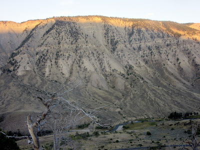
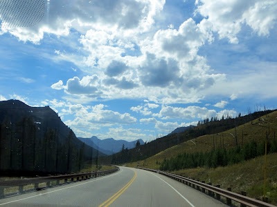
The highways around the Northeast Entrance have outstanding
scenery.
 |
| The upper section of Soda Butte Creek. |
 |
| The white cone shaped dome that smells like sulpher is Soda Butte. |
 |
| Mule deer posing by the side of the road for us. Also known as blackmail deer. |
We originally was going to hike into a lake called Trout
Lake and check it out. It is a mile hike
to the lake from the trailhead off the highway.
It is a fly fishing destination and is full of Cutthroats. In the spring, during spawning, the trout
congregate at the mouth of a creek on the north side of the lake. The bears also congregate there to eat the
fish. For this reason, the lake and
trail is closed to fishing during that time.
We had to abort that hike because Marsha had taken some allergy medicine
that was not the “won’t make you drowsy” type.


No comments:
Post a Comment